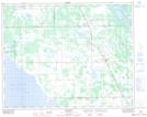
Maps showing Pine Lake Drain, Manitoba
Pine Lake Drain is a Hydraulic construction located in Manitoba and has an elevation of 254 meters.
- Latitude: 50° 49' 45'' North (decimal: 50.8292000)
- Longitude: 98° 23' 42'' West (decimal: -98.3949999)
- Topography Feature Category: Hydraulic construction
- Geographical Feature: Drain
- Canadian Province/Territory: Manitoba
- Elevation: 254 meters
- Atlas of Canada Locator Map: Pine Lake Drain
- GPS Coordinate Locator Map: Pine Lake Drain Lat/Long