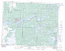
Maps showing Pine Point Rapids, 25,26-13-14-E, Manitoba
Pine Point Rapids is a Rapids located in 25,26-13-14-E, Manitoba and has an elevation of 297 meters.
- Latitude: 50° 6' 36'' North (decimal: 50.1099999)
- Longitude: 95° 34' 15'' West (decimal: -95.5708000)
- Topography Feature Category: Rapids
- Geographical Feature: Rapids
- Canadian Province/Territory: Manitoba
- Elevation: 297 meters
- Location: 25,26-13-14-E
- Atlas of Canada Locator Map: Pine Point Rapids
- GPS Coordinate Locator Map: Pine Point Rapids Lat/Long
Pine Point Rapids NTS Map Sheets