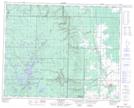
Maps showing Pine River, 32,33-32-22-W, Manitoba
Pine River is a Unincorporated area located in 32,33-32-22-W, Manitoba and has an elevation of 356 meters.
- Latitude: 51° 47' 3'' North (decimal: 51.7842000)
- Longitude: 100° 31' 50'' West (decimal: -100.5305999)
- Topography Feature Category: Unincorporated area
- Geographical Feature: Local Urban District
- Canadian Province/Territory: Manitoba
- Elevation: 356 meters
- Location: 32,33-32-22-W
- Atlas of Canada Locator Map: Pine River
- GPS Coordinate Locator Map: Pine River Lat/Long
Pine River NTS Map Sheets