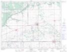
Maps showing Pinkerton Lakes, 7-10-W, Manitoba
Pinkerton Lakes is a Lake located in 7-10-W, Manitoba and has an elevation of 456 meters.
- Latitude: 49° 32' 37'' North (decimal: 49.5436000)
- Longitude: 98° 41' 53'' West (decimal: -98.6980999)
- Topography Feature Category: Lake
- Geographical Feature: Lakes
- Canadian Province/Territory: Manitoba
- Elevation: 456 meters
- Location: 7-10-W
- Atlas of Canada Locator Map: Pinkerton Lakes
- GPS Coordinate Locator Map: Pinkerton Lakes Lat/Long