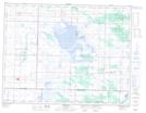
Maps showing Pipestone Creek Diversion, 22-8-25-W, Manitoba
Pipestone Creek Diversion is a Hydraulic construction located in 22-8-25-W, Manitoba and has an elevation of 424 meters.
- Latitude: 49° 40' 25'' North (decimal: 49.6735999)
- Longitude: 100° 48' 16'' West (decimal: -100.8043999)
- Topography Feature Category: Hydraulic construction
- Geographical Feature: Diversion
- Canadian Province/Territory: Manitoba
- Elevation: 424 meters
- Location: 22-8-25-W
- Atlas of Canada Locator Map: Pipestone Creek Diversion
- GPS Coordinate Locator Map: Pipestone Creek Diversion Lat/Long