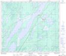
Maps showing Pipun, 34-67-9-W, Manitoba
Pipun is a Unincorporated area located in 34-67-9-W, Manitoba and has an elevation of 226 meters.
- Latitude: 54° 50' 19'' North (decimal: 54.8385999)
- Longitude: 98° 45' 13'' West (decimal: -98.7536000)
- Topography Feature Category: Unincorporated area
- Geographical Feature: Railway Point
- Canadian Province/Territory: Manitoba
- Elevation: 226 meters
- Location: 34-67-9-W
- Atlas of Canada Locator Map: Pipun
- GPS Coordinate Locator Map: Pipun Lat/Long
Pipun NTS Map Sheets