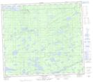
Maps showing Pit Siding, 5,9-80-8-E, Manitoba
Pit Siding is a Unincorporated area located in 5,9-80-8-E, Manitoba and has an elevation of 213 meters.
- Latitude: 55° 54' 34'' North (decimal: 55.9093999)
- Longitude: 96° 19' 3'' West (decimal: -96.3174999)
- Topography Feature Category: Unincorporated area
- Geographical Feature: Community
- Canadian Province/Territory: Manitoba
- Elevation: 213 meters
- Location: 5,9-80-8-E
- Atlas of Canada Locator Map: Pit Siding
- GPS Coordinate Locator Map: Pit Siding Lat/Long