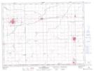
Maps showing Plum Coulee, 2,11-3-3-W, Manitoba
Plum Coulee is a Town located in 2,11-3-3-W, Manitoba and has an elevation of 255 meters.
- Latitude: 49° 11' 28'' North (decimal: 49.1911000)
- Longitude: 97° 45' 38'' West (decimal: -97.7605999)
- Topography Feature Category: Town
- Geographical Feature: Town
- Canadian Province/Territory: Manitoba
- Elevation: 255 meters
- Location: 2,11-3-3-W
- Atlas of Canada Locator Map: Plum Coulee
- GPS Coordinate Locator Map: Plum Coulee Lat/Long