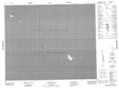
Maps showing Poplar Point Reef, Manitoba
Poplar Point Reef is a Shoal located in Manitoba.
- Latitude: 52° 59' 50'' North (decimal: 52.9972000)
- Longitude: 97° 36' 20'' West (decimal: -97.6055999)
- Topography Feature Category: Shoal
- Geographical Feature: Reef
- Canadian Province/Territory: Manitoba
- Atlas of Canada Locator Map: Poplar Point Reef
- GPS Coordinate Locator Map: Poplar Point Reef Lat/Long
Poplar Point Reef NTS Map Sheets