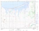
Maps showing Portage Creek Bay, 4,5-14-6-W, Manitoba
Portage Creek Bay is a Bay located in 4,5-14-6-W, Manitoba.
- Latitude: 50° 9' 46'' North (decimal: 50.1628000)
- Longitude: 98° 13' 54'' West (decimal: -98.2316999)
- Topography Feature Category: Bay
- Geographical Feature: Bay
- Canadian Province/Territory: Manitoba
- Location: 4,5-14-6-W
- Atlas of Canada Locator Map: Portage Creek Bay
- GPS Coordinate Locator Map: Portage Creek Bay Lat/Long