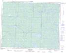
Maps showing Port Lake, 23-15-E, Manitoba
Port Lake is a Lake located in 23-15-E, Manitoba and has an elevation of 312 meters.
- Latitude: 50° 56' 16'' North (decimal: 50.9377999)
- Longitude: 95° 22' 17'' West (decimal: -95.3714000)
- Topography Feature Category: Lake
- Geographical Feature: Lake
- Canadian Province/Territory: Manitoba
- Elevation: 312 meters
- Location: 23-15-E
- Atlas of Canada Locator Map: Port Lake
- GPS Coordinate Locator Map: Port Lake Lat/Long
Port Lake NTS Map Sheets