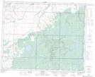
Maps showing Pretty Valley, 34,35-27-W, Manitoba
Pretty Valley is a Unincorporated area located in 34,35-27-W, Manitoba and has an elevation of 407 meters.
- Latitude: 51° 58' 8'' North (decimal: 51.9689000)
- Longitude: 101° 15' 4'' West (decimal: -101.2511000)
- Topography Feature Category: Unincorporated area
- Geographical Feature: Locality
- Canadian Province/Territory: Manitoba
- Elevation: 407 meters
- Location: 34,35-27-W
- Atlas of Canada Locator Map: Pretty Valley
- GPS Coordinate Locator Map: Pretty Valley Lat/Long
Pretty Valley NTS Map Sheets