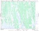
Maps showing Proulx Creek, 26,33-32-13-W, Manitoba
Proulx Creek is a River located in 26,33-32-13-W, Manitoba and has an elevation of 269 meters.
- Latitude: 51° 46' 40'' North (decimal: 51.7777999)
- Longitude: 99° 11' 38'' West (decimal: -99.1939000)
- Topography Feature Category: River
- Geographical Feature: Creek
- Canadian Province/Territory: Manitoba
- Elevation: 269 meters
- Location: 26,33-32-13-W
- Atlas of Canada Locator Map: Proulx Creek
- GPS Coordinate Locator Map: Proulx Creek Lat/Long
Proulx Creek NTS Map Sheets