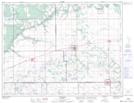
Maps showing Rankin Flats, 35-8-11-W, Manitoba
Rankin Flats is a Plain located in 35-8-11-W, Manitoba and has an elevation of 312 meters.
- Latitude: 49° 41' 56'' North (decimal: 49.6989000)
- Longitude: 98° 51' 46'' West (decimal: -98.8628000)
- Topography Feature Category: Plain
- Geographical Feature: Flats
- Canadian Province/Territory: Manitoba
- Elevation: 312 meters
- Location: 35-8-11-W
- Atlas of Canada Locator Map: Rankin Flats
- GPS Coordinate Locator Map: Rankin Flats Lat/Long