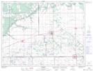
Maps showing Rathwell, 7-8-8-W, Manitoba
Rathwell is a Unincorporated area located in 7-8-8-W, Manitoba and has an elevation of 321 meters.
- Latitude: 49° 38' 49'' North (decimal: 49.6469000)
- Longitude: 98° 32' 47'' West (decimal: -98.5463999)
- Topography Feature Category: Unincorporated area
- Geographical Feature: Local Urban District
- Canadian Province/Territory: Manitoba
- Elevation: 321 meters
- Location: 7-8-8-W
- Atlas of Canada Locator Map: Rathwell
- GPS Coordinate Locator Map: Rathwell Lat/Long