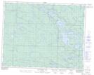
Maps showing Rat Lake, 20,21-13-E, Manitoba
Rat Lake is a Lake located in 20,21-13-E, Manitoba and has an elevation of 304 meters.
- Latitude: 50° 44' 38'' North (decimal: 50.7439000)
- Longitude: 95° 42' 9'' West (decimal: -95.7025000)
- Topography Feature Category: Lake
- Geographical Feature: Lake
- Canadian Province/Territory: Manitoba
- Elevation: 304 meters
- Location: 20,21-13-E
- Atlas of Canada Locator Map: Rat Lake
- GPS Coordinate Locator Map: Rat Lake Lat/Long
Rat Lake NTS Map Sheets