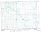
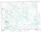
Maps showing Rat River Swamp, 3-6,7-E, Manitoba
Rat River Swamp is a Low vegetation located in 3-6,7-E, Manitoba and has an elevation of 291 meters.
- Latitude: 49° 12' 49'' North (decimal: 49.2135999)
- Longitude: 96° 41' 13'' West (decimal: -96.6868999)
- Topography Feature Category: Low vegetation
- Geographical Feature: Swamp
- Canadian Province/Territory: Manitoba
- Elevation: 291 meters
- Location: 3-6,7-E
- Atlas of Canada Locator Map: Rat River Swamp
- GPS Coordinate Locator Map: Rat River Swamp Lat/Long
Rat River Swamp NTS Map Sheets