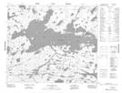
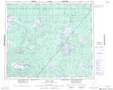
Maps showing Red Sucker Lake, Manitoba
Red Sucker Lake is a Unincorporated area located in Manitoba.
- Latitude: 54° 9' 36'' North (decimal: 54.1600000)
- Longitude: 93° 34' 2'' West (decimal: -93.5672000)
- Topography Feature Category: Unincorporated area
- Geographical Feature: Northern Community
- Canadian Province/Territory: Manitoba
- Atlas of Canada Locator Map: Red Sucker Lake
- GPS Coordinate Locator Map: Red Sucker Lake Lat/Long
Red Sucker Lake NTS Map Sheets