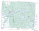
Maps showing Reed Falls, Manitoba
Reed Falls is a Falls located in Manitoba and has an elevation of 314 meters.
- Latitude: 50° 2' 4'' North (decimal: 50.0343999)
- Longitude: 95° 30' 22'' West (decimal: -95.5060999)
- Topography Feature Category: Falls
- Geographical Feature: Falls
- Canadian Province/Territory: Manitoba
- Elevation: 314 meters
- Atlas of Canada Locator Map: Reed Falls
- GPS Coordinate Locator Map: Reed Falls Lat/Long
Reed Falls NTS Map Sheets