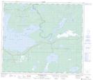
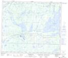
Maps showing Reed Lake, 65,66-20,21-W, Manitoba
Reed Lake is a Lake located in 65,66-20,21-W, Manitoba and has an elevation of 285 meters.
- Latitude: 54° 38' 00'' North (decimal: 54.6333000)
- Longitude: 100° 29' 59'' West (decimal: -100.4997000)
- Topography Feature Category: Lake
- Geographical Feature: Lake
- Canadian Province/Territory: Manitoba
- Elevation: 285 meters
- Location: 65,66-20,21-W
- Atlas of Canada Locator Map: Reed Lake
- GPS Coordinate Locator Map: Reed Lake Lat/Long
Reed Lake NTS Map Sheets