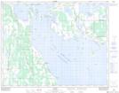
Maps showing Reedy Creek, 33-22-11-W, Manitoba
Reedy Creek is a Unincorporated area located in 33-22-11-W, Manitoba and has an elevation of 249 meters.
- Latitude: 50° 56' 47'' North (decimal: 50.9463999)
- Longitude: 98° 55' 36'' West (decimal: -98.9267000)
- Topography Feature Category: Unincorporated area
- Geographical Feature: Locality
- Canadian Province/Territory: Manitoba
- Elevation: 249 meters
- Location: 33-22-11-W
- Atlas of Canada Locator Map: Reedy Creek
- GPS Coordinate Locator Map: Reedy Creek Lat/Long