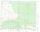
Maps showing Renwer, 15-36-24-W, Manitoba
Renwer is a Unincorporated area located in 15-36-24-W, Manitoba and has an elevation of 349 meters.
- Latitude: 52° 5' 51'' North (decimal: 52.0974999)
- Longitude: 100° 48' 47'' West (decimal: -100.8131000)
- Topography Feature Category: Unincorporated area
- Geographical Feature: Community
- Canadian Province/Territory: Manitoba
- Elevation: 349 meters
- Location: 15-36-24-W
- Atlas of Canada Locator Map: Renwer
- GPS Coordinate Locator Map: Renwer Lat/Long