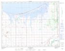
Maps showing Richies Slough, Manitoba
Richies Slough is a Low vegetation located in Manitoba.
- Latitude: 50° 9' 57'' North (decimal: 50.1657999)
- Longitude: 98° 18' 14'' West (decimal: -98.3038999)
- Topography Feature Category: Low vegetation
- Geographical Feature: Slough
- Canadian Province/Territory: Manitoba
- Atlas of Canada Locator Map: Richies Slough
- GPS Coordinate Locator Map: Richies Slough Lat/Long