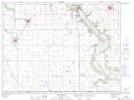
Maps showing Rinns Point, 30-1-8-W, Manitoba
Rinns Point is a Cape located in 30-1-8-W, Manitoba and has an elevation of 440 meters.
- Latitude: 49° 3' 59'' North (decimal: 49.0664000)
- Longitude: 98° 30' 58'' West (decimal: -98.5161000)
- Topography Feature Category: Cape
- Geographical Feature: Point
- Canadian Province/Territory: Manitoba
- Elevation: 440 meters
- Location: 30-1-8-W
- Atlas of Canada Locator Map: Rinns Point
- GPS Coordinate Locator Map: Rinns Point Lat/Long
Rinns Point NTS Map Sheets