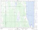
Maps showing Ritchot Point, 5,8-28-12-W, Manitoba
Ritchot Point is a Cape located in 5,8-28-12-W, Manitoba and has an elevation of 255 meters.
- Latitude: 51° 22' 42'' North (decimal: 51.3783000)
- Longitude: 99° 6' 19'' West (decimal: -99.1053000)
- Topography Feature Category: Cape
- Geographical Feature: Point
- Canadian Province/Territory: Manitoba
- Elevation: 255 meters
- Location: 5,8-28-12-W
- Atlas of Canada Locator Map: Ritchot Point
- GPS Coordinate Locator Map: Ritchot Point Lat/Long