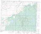
Maps showing Roaring River Canyon, 33,34-27-W, Manitoba
Roaring River Canyon is a Valley located in 33,34-27-W, Manitoba and has an elevation of 480 meters.
- Latitude: 51° 51' 36'' North (decimal: 51.8599999)
- Longitude: 101° 13' 37'' West (decimal: -101.2269000)
- Topography Feature Category: Valley
- Geographical Feature: Canyon
- Canadian Province/Territory: Manitoba
- Elevation: 480 meters
- Location: 33,34-27-W
- Atlas of Canada Locator Map: Roaring River Canyon
- GPS Coordinate Locator Map: Roaring River Canyon Lat/Long
Roaring River Canyon NTS Map Sheets