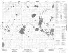
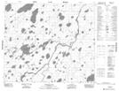
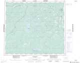
Maps showing Robin Lake, 69,70-4-E2, Manitoba
Robin Lake is a Lake located in 69,70-4-E2, Manitoba and has an elevation of 176 meters.
- Latitude: 55° 0' 57'' North (decimal: 55.0158000)
- Longitude: 93° 30' 15'' West (decimal: -93.5042000)
- Topography Feature Category: Lake
- Geographical Feature: Lake
- Canadian Province/Territory: Manitoba
- Elevation: 176 meters
- Location: 69,70-4-E2
- Atlas of Canada Locator Map: Robin Lake
- GPS Coordinate Locator Map: Robin Lake Lat/Long
Robin Lake NTS Map Sheets