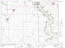
Maps showing Robinsons Slough, 27-3-9-W, Manitoba
Robinsons Slough is a Low vegetation located in 27-3-9-W, Manitoba and has an elevation of 482 meters.
- Latitude: 49° 14' 27'' North (decimal: 49.2407999)
- Longitude: 98° 35' 55'' West (decimal: -98.5985999)
- Topography Feature Category: Low vegetation
- Geographical Feature: Slough
- Canadian Province/Territory: Manitoba
- Elevation: 482 meters
- Location: 27-3-9-W
- Atlas of Canada Locator Map: Robinsons Slough
- GPS Coordinate Locator Map: Robinsons Slough Lat/Long
Robinsons Slough NTS Map Sheets