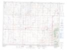
Maps showing Robinsons Slough, 14,15-2-25-W, Manitoba
Robinsons Slough is a Low vegetation located in 14,15-2-25-W, Manitoba.
- Latitude: 49° 7' 20'' North (decimal: 49.1222000)
- Longitude: 100° 44' 6'' West (decimal: -100.7349999)
- Topography Feature Category: Low vegetation
- Geographical Feature: Slough
- Canadian Province/Territory: Manitoba
- Location: 14,15-2-25-W
- Atlas of Canada Locator Map: Robinsons Slough
- GPS Coordinate Locator Map: Robinsons Slough Lat/Long