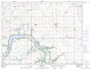
Maps showing Roelands Sloughs, Manitoba
Roelands Sloughs is a Low vegetation located in Manitoba.
- Latitude: 49° 23' 3'' North (decimal: 49.3842000)
- Longitude: 98° 56' 41'' West (decimal: -98.9447000)
- Topography Feature Category: Low vegetation
- Geographical Feature: Sloughs
- Canadian Province/Territory: Manitoba
- GPS Coordinate Locator Map: Roelands Sloughs Lat/Long