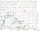
Maps showing Lac Rondeau, 30-4-8-W, Manitoba
Lac Rondeau is a Lake located in 30-4-8-W, Manitoba and has an elevation of 490 meters.
- Latitude: 49° 20' 15'' North (decimal: 49.3374999)
- Longitude: 98° 32' 25'' West (decimal: -98.5403000)
- Topography Feature Category: Lake
- Geographical Feature: Lac
- Canadian Province/Territory: Manitoba
- Elevation: 490 meters
- Location: 30-4-8-W
- Atlas of Canada Locator Map: Lac Rondeau
- GPS Coordinate Locator Map: Lac Rondeau Lat/Long