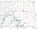
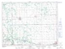
Maps showing Roseisle Creek, 34-6-7-W, Manitoba
Roseisle Creek is a River located in 34-6-7-W, Manitoba and has an elevation of 465 meters.
- Latitude: 49° 31' 21'' North (decimal: 49.5225000)
- Longitude: 98° 19' 22'' West (decimal: -98.3228000)
- Topography Feature Category: River
- Geographical Feature: Creek
- Canadian Province/Territory: Manitoba
- Elevation: 465 meters
- Location: 34-6-7-W
- Atlas of Canada Locator Map: Roseisle Creek
- GPS Coordinate Locator Map: Roseisle Creek Lat/Long
Roseisle Creek NTS Map Sheets