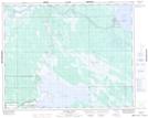
Maps showing Ross Point, Manitoba
Ross Point is a Cape located in Manitoba and has an elevation of 217 meters.
- Latitude: 51° 57' 30'' North (decimal: 51.9582999)
- Longitude: 98° 3' 2'' West (decimal: -98.0506000)
- Topography Feature Category: Cape
- Geographical Feature: Point
- Canadian Province/Territory: Manitoba
- Elevation: 217 meters
- Atlas of Canada Locator Map: Ross Point
- GPS Coordinate Locator Map: Ross Point Lat/Long
Ross Point NTS Map Sheets