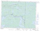
Maps showing Rush Lake, 17-16-E, Manitoba
Rush Lake is a Lake located in 17-16-E, Manitoba and has an elevation of 306 meters.
- Latitude: 50° 26' 12'' North (decimal: 50.4366999)
- Longitude: 95° 21' 43'' West (decimal: -95.3618999)
- Topography Feature Category: Lake
- Geographical Feature: Lake
- Canadian Province/Territory: Manitoba
- Elevation: 306 meters
- Location: 17-16-E
- Atlas of Canada Locator Map: Rush Lake
- GPS Coordinate Locator Map: Rush Lake Lat/Long
Rush Lake NTS Map Sheets