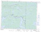
Maps showing Ryerson Lake, 16-17-E, Manitoba
Ryerson Lake is a Lake located in 16-17-E, Manitoba and has an elevation of 317 meters.
- Latitude: 50° 23' 16'' North (decimal: 50.3878000)
- Longitude: 95° 10' 37'' West (decimal: -95.1769000)
- Topography Feature Category: Lake
- Geographical Feature: Lake
- Canadian Province/Territory: Manitoba
- Elevation: 317 meters
- Location: 16-17-E
- Atlas of Canada Locator Map: Ryerson Lake
- GPS Coordinate Locator Map: Ryerson Lake Lat/Long
Ryerson Lake NTS Map Sheets