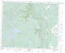
Maps showing Sable Mountain, 9,10-41-27-W, Manitoba
Sable Mountain is a Mountain located in 9,10-41-27-W, Manitoba and has an elevation of 701 meters.
- Latitude: 52° 30' 48'' North (decimal: 52.5133000)
- Longitude: 101° 16' 40'' West (decimal: -101.2777999)
- Topography Feature Category: Mountain
- Geographical Feature: Mountain
- Canadian Province/Territory: Manitoba
- Elevation: 701 meters
- Location: 9,10-41-27-W
- Atlas of Canada Locator Map: Sable Mountain
- GPS Coordinate Locator Map: Sable Mountain Lat/Long