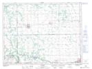
Maps showing St. Claude, 15-8-7-W, Manitoba
St. Claude is a Village located in 15-8-7-W, Manitoba and has an elevation of 307 meters.
- Latitude: 49° 39' 31'' North (decimal: 49.6586000)
- Longitude: 98° 20' 30'' West (decimal: -98.3416999)
- Topography Feature Category: Village
- Geographical Feature: Village
- Canadian Province/Territory: Manitoba
- Elevation: 307 meters
- Location: 15-8-7-W
- Atlas of Canada Locator Map: St. Claude
- GPS Coordinate Locator Map: St. Claude Lat/Long