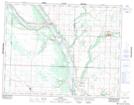
Maps showing St-Lazare, 17-17-28-W, Manitoba
St-Lazare is a Village located in 17-17-28-W, Manitoba and has an elevation of 413 meters.
- Latitude: 50° 26' 56'' North (decimal: 50.4488999)
- Longitude: 101° 18' 15'' West (decimal: -101.3041999)
- Topography Feature Category: Village
- Geographical Feature: Village
- Canadian Province/Territory: Manitoba
- Elevation: 413 meters
- Location: 17-17-28-W
- Atlas of Canada Locator Map: St-Lazare
- GPS Coordinate Locator Map: St-Lazare Lat/Long
St-Lazare NTS Map Sheets