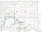
Maps showing Lac St. Leon, 2-5-9-W, Manitoba
Lac St. Leon is a Lake located in 2-5-9-W, Manitoba and has an elevation of 488 meters.
- Latitude: 49° 21' 37'' North (decimal: 49.3603000)
- Longitude: 98° 35' 4'' West (decimal: -98.5844000)
- Topography Feature Category: Lake
- Geographical Feature: Lac
- Canadian Province/Territory: Manitoba
- Elevation: 488 meters
- Location: 2-5-9-W
- Atlas of Canada Locator Map: Lac St. Leon
- GPS Coordinate Locator Map: Lac St. Leon Lat/Long