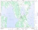
Maps showing St. Martin Junction, 31,32-9,10-W, Manitoba
St. Martin Junction is a Unincorporated area located in 31,32-9,10-W, Manitoba and has an elevation of 257 meters.
- Latitude: 51° 42' 41'' North (decimal: 51.7113999)
- Longitude: 98° 44' 6'' West (decimal: -98.7350000)
- Topography Feature Category: Unincorporated area
- Geographical Feature: Community
- Canadian Province/Territory: Manitoba
- Elevation: 257 meters
- Location: 31,32-9,10-W
- Atlas of Canada Locator Map: St. Martin Junction
- GPS Coordinate Locator Map: St. Martin Junction Lat/Long
St. Martin Junction NTS Map Sheets