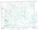
Maps showing St. Pierre Sud, 10-5-4-E, Manitoba
St. Pierre Sud is a Unincorporated area located in 10-5-4-E, Manitoba and has an elevation of 241 meters.
- Latitude: 49° 22' 45'' North (decimal: 49.3792000)
- Longitude: 96° 59' 3'' West (decimal: -96.9842000)
- Topography Feature Category: Unincorporated area
- Geographical Feature: Locality
- Canadian Province/Territory: Manitoba
- Elevation: 241 meters
- Location: 10-5-4-E
- Atlas of Canada Locator Map: St. Pierre Sud
- GPS Coordinate Locator Map: St. Pierre Sud Lat/Long