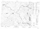
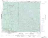
Maps showing Sakakoneekum Portage, Manitoba
Sakakoneekum Portage is a Road feature located in Manitoba.
- Latitude: 51° 28' 44'' North (decimal: 51.4789000)
- Longitude: 95° 33' 15'' West (decimal: -95.5541999)
- Topography Feature Category: Road feature
- Geographical Feature: Portage
- Canadian Province/Territory: Manitoba
- Atlas of Canada Locator Map: Sakakoneekum Portage
- GPS Coordinate Locator Map: Sakakoneekum Portage Lat/Long
Sakakoneekum Portage NTS Map Sheets