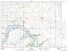
Maps showing Salt Lake, 3-4-11-W, Manitoba
Salt Lake is a Lake located in 3-4-11-W, Manitoba and has an elevation of 461 meters.
- Latitude: 49° 16' 28'' North (decimal: 49.2743999)
- Longitude: 98° 52' 2'' West (decimal: -98.8671999)
- Topography Feature Category: Lake
- Geographical Feature: Lake
- Canadian Province/Territory: Manitoba
- Elevation: 461 meters
- Location: 3-4-11-W
- Atlas of Canada Locator Map: Salt Lake
- GPS Coordinate Locator Map: Salt Lake Lat/Long