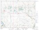
Maps showing Saltwater Lake, 1-6-15-W, Manitoba
Saltwater Lake is a Lake located in 1-6-15-W, Manitoba and has an elevation of 423 meters.
- Latitude: 49° 27' 17'' North (decimal: 49.4547000)
- Longitude: 99° 22' 26'' West (decimal: -99.3739000)
- Topography Feature Category: Lake
- Geographical Feature: Lake
- Canadian Province/Territory: Manitoba
- Elevation: 423 meters
- Location: 1-6-15-W
- Atlas of Canada Locator Map: Saltwater Lake
- GPS Coordinate Locator Map: Saltwater Lake Lat/Long