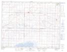
Maps showing The Sand Bars, 33,4-3,4-21-W, Manitoba
The Sand Bars is a Shoal located in 33,4-3,4-21-W, Manitoba and has an elevation of 510 meters.
- Latitude: 49° 16' 10'' North (decimal: 49.2693999)
- Longitude: 100° 15' 35'' West (decimal: -100.2596999)
- Topography Feature Category: Shoal
- Geographical Feature: Bars
- Canadian Province/Territory: Manitoba
- Elevation: 510 meters
- Location: 33,4-3,4-21-W
- Atlas of Canada Locator Map: The Sand Bars
- GPS Coordinate Locator Map: The Sand Bars Lat/Long