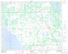
Maps showing School Lake, 10-23-5-W, Manitoba
School Lake is a Lake located in 10-23-5-W, Manitoba and has an elevation of 275 meters.
- Latitude: 50° 58' 33'' North (decimal: 50.9758000)
- Longitude: 98° 4' 36'' West (decimal: -98.0767000)
- Topography Feature Category: Lake
- Geographical Feature: Lake
- Canadian Province/Territory: Manitoba
- Elevation: 275 meters
- Location: 10-23-5-W
- Atlas of Canada Locator Map: School Lake
- GPS Coordinate Locator Map: School Lake Lat/Long