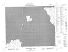
Maps showing Seagull Rock, Manitoba
Seagull Rock is a Shoal located in Manitoba.
- Latitude: 52° 13' 4'' North (decimal: 52.2178000)
- Longitude: 97° 17' 29'' West (decimal: -97.2914000)
- Topography Feature Category: Shoal
- Geographical Feature: Rock
- Canadian Province/Territory: Manitoba
- Atlas of Canada Locator Map: Seagull Rock
- GPS Coordinate Locator Map: Seagull Rock Lat/Long
Seagull Rock NTS Map Sheets