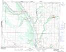
Maps showing Seales Slough, 3-16-27-W, Manitoba
Seales Slough is a Low vegetation located in 3-16-27-W, Manitoba and has an elevation of 479 meters.
- Latitude: 50° 19' 51'' North (decimal: 50.3307999)
- Longitude: 101° 6' 39'' West (decimal: -101.1107999)
- Topography Feature Category: Low vegetation
- Geographical Feature: Slough
- Canadian Province/Territory: Manitoba
- Elevation: 479 meters
- Location: 3-16-27-W
- Atlas of Canada Locator Map: Seales Slough
- GPS Coordinate Locator Map: Seales Slough Lat/Long
Seales Slough NTS Map Sheets