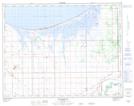
Maps showing Short Creek, 14-7-W, Manitoba
Short Creek is a River located in 14-7-W, Manitoba and has an elevation of 252 meters.
- Latitude: 50° 9' 44'' North (decimal: 50.1621999)
- Longitude: 98° 25' 16'' West (decimal: -98.4211000)
- Topography Feature Category: River
- Geographical Feature: Creek
- Canadian Province/Territory: Manitoba
- Elevation: 252 meters
- Location: 14-7-W
- Atlas of Canada Locator Map: Short Creek
- GPS Coordinate Locator Map: Short Creek Lat/Long