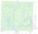
Maps showing Shortie Lake, 34-89-22-W, Manitoba
Shortie Lake is a Lake located in 34-89-22-W, Manitoba and has an elevation of 335 meters.
- Latitude: 56° 45' 35'' North (decimal: 56.7596999)
- Longitude: 100° 52' 28'' West (decimal: -100.8744000)
- Topography Feature Category: Lake
- Geographical Feature: Lake
- Canadian Province/Territory: Manitoba
- Elevation: 335 meters
- Location: 34-89-22-W
- Atlas of Canada Locator Map: Shortie Lake
- GPS Coordinate Locator Map: Shortie Lake Lat/Long
Shortie Lake NTS Map Sheets